


Explore the Best Hiking Destinations in the Canary Islands
The Canary Islands are a privileged destination for those who enjoy exploring landscapes on foot. Beyond its beaches and mild climate, the archipelago offers an impressive network of trails that cross volcanic mountains, lush pine forests, deep ravines, natural parks, and spectacular coastal cliffs.
Each island has its own personality, making hiking a unique way to experience its geographical and natural diversity.
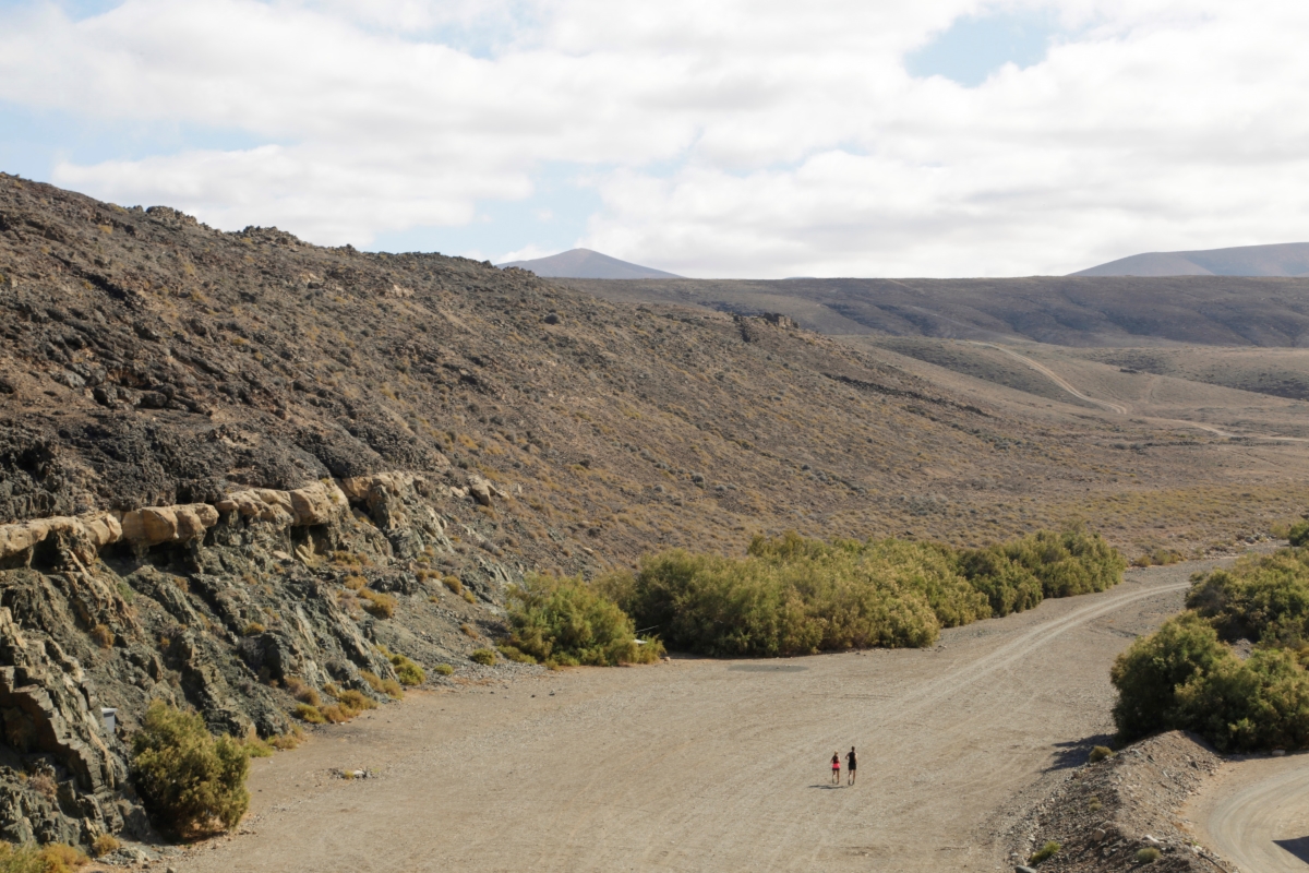
From the highest peaks of Tenerife or La Palma to the flat paths through volcanic badlands and arid zones of Fuerteventura, as well as coastal routes and rural tracks in Gran Canaria, hiking in the Canary Islands caters to all levels. There are easy routes for beginners, as well as physically and technically demanding trails for the more experienced.
Many trails are clearly signposted and classified under European standards (GR, PR…), and can be explored independently or on organised tours with specialised guides. All of this within an unmatched natural setting and under a friendly climate that allows for year-round outdoor activity.
Hiking in Fuerteventura
Reach the Highest Peak in Fuerteventura
Fuerteventura is not just about sun and beach. The route to Pico de la Zarza is a perfect alternative for hiking enthusiasts and lovers of great views.
Pico de la Zarza stands at 813 metres above sea level. It is considered the highest mountain on Fuerteventura and, therefore, a perfect viewpoint to take in the volcanoes and landscape of the Jandía Peninsula, the beaches of Barlovento and Cofete, and the ravines of Vinamar and the Valley of Butihondo.
To reach the summit, you simply follow an easy hiking trail starting from Morro Jable that takes just about three hours. It’s a comfortable ascent along well-marked paths. Although it’s an easy climb, don’t forget to bring water and sun protection. Fuerteventura’s climate demands good hydration. And speaking of the weather: if you want to enjoy the best views from Pico de la Zarza, check the weather to avoid days with calima or fog—common in summer—which can reduce visibility.
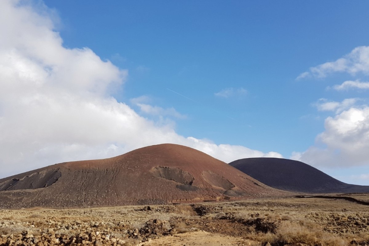
Hike Up to the Crater of Calderón Hondo
Fuerteventura youngest volcano is called Calderón Hondo and is over 50,000 years old.
It is located in the municipality of La Oliva, specifically in Lajares. Access is very straightforward and well signposted. To reach its 278-metre summit, follow a 2.8-kilometre trail that starts in the town. After walking a relatively flat dirt path, you’ll find two forks. It doesn’t matter which you choose, as both lead to the top, although the path on the right is easier.
Upon reaching the summit, you’ll be doubly amazed. First, by the Calderón Hondo crater, 70 metres deep and in good condition, with visible traces of sulphur. You’ll also be stunned by the views: spectacular panoramas not only of Corralejo, Lobos Island and the neighbouring island of Lanzarote, but also of the Bayuyo alignment—a chain of volcanoes responsible for over 120 kilometres of Fuerteventura’s surface.
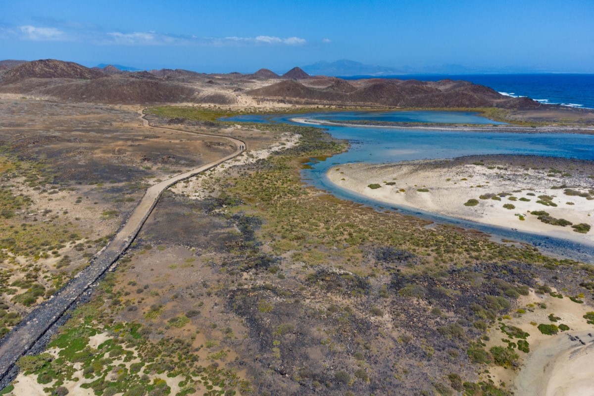
Circular Route on Lobos Island
Have you visited the wonderful Lobos Island? A small islet north of Fuerteventura that is part of the Corralejo Dunes Natural Park.
If you want to uncover its secrets, we recommend taking the circular route by foot or bike. Even though it’s the smallest island in the Canary archipelago, covering just about six square kilometres, it features a wide variety of landscapes and wildlife, as well as idyllic beaches that make this walk a unique experience.
The route starts at the jetty, where you can arrive by boat. One of the highlights is the visit to the Martiño lighthouse at the island’s northern tip, offering stunning panoramic views of the ocean and the Fuerteventura coastline. It’s also the perfect spot to watch the sunset, when the warm colours of the sun reflect on the volcanic landscape, creating a unique scene.
Another unmissable stop is La Concha Beach, with white sand and crystal-clear waters—ideal for a refreshing swim after the hike, or even for snorkelling! It’s a perfect place to relax and enjoy this magnificent natural environment.
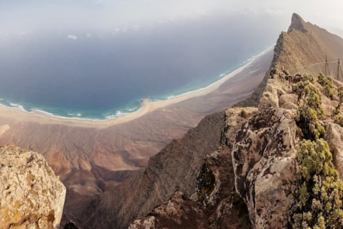
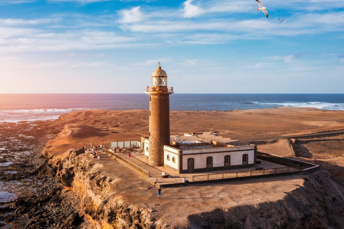
Nature and Adventure in Fuerteventura: Hiking to the Jandía Lighthouse
Fancy an adventure that blends landscapes and breathtaking seaside views on your trip to Fuerteventura? We recommend the hiking route to the Jandía Lighthouse. This trail leads to the southernmost tip of the island, Punta de Jandía, and can be completed on foot or by bike.
It’s the ninth stage of the GR-131 and spans about 20 kilometres, although you can start from other points along the way to shorten the itinerary. We recommend carrying plenty of water.
The journey begins in the fishing village of Morro Jable. Heading south, you’ll reach a viewpoint with magnificent sea views. Continue along the marked trail until you reach the cemetery, where an unpaved track begins that runs along the coast. After crossing the vast plains, you’ll arrive at a rest area overlooking the beautiful Jorós Valley. Further on, you’ll pass through the small village of El Puertito de la Cruz, known for its windmill and delicious fish broth. Your walk ends at the impressive Punta de Jandía lighthouse.
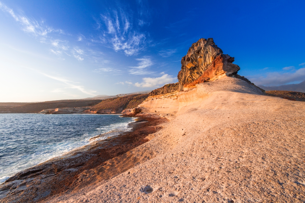
Venture into the Ajuy Caves
Did you know Fuerteventura has more to offer than just white sandy beaches? On the island’s western edge lies a magical place called Ajuy, located in the municipality of Pájara. Along its coast are the famous Ajuy Caves—towering rock formations that are among the island’s most prominent natural monuments.
These caves and their location were used hundreds of years ago as a lime export point. According to history, pirates also chose the site to trade goods along the coast.
Over time, the crashing waves and wind have slowly eroded the caves, giving them their mesmerising natural shapes. These rocks are the oldest in the Canaries and have been declared a Natural Monument and Protected Natural Area.
This protected area features an easy trail, making it ideal for family walks. You can observe the old jetty, lime kilns, and several viewpoints. To reach the Ajuy Caves, follow a short 1-kilometre path along the cliffs. It begins at Ajuy beach, known for its spectacular black volcanic sand. Prepare to be amazed!
Hiking in Tenerife
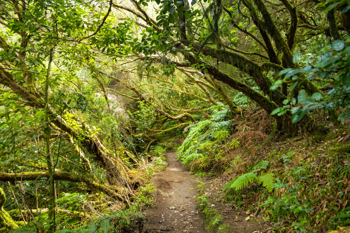
Discover the Secrets of Anaga Rural Park
Anaga Rural Park, declared a Biosphere Reserve, is a haven for nature and hiking lovers. This area stands out for its striking ravines and vast valleys, but also for trails that take you deep into the heart of the laurel forest.
Perhaps the best-known walk is the Sendero de Los Sentidos. It follows an old royal road that once connected La Laguna with the villages of Anaga and has been restored so visitors can learn about its history and the surrounding environment, engaging with nature itself.
In fact, the Trail of the Senses is divided into three routes, all low in difficulty and easily accessible. One of the routes is adapted for people with reduced mobility and leads to the Llano de los Loros Viewpoint, which offers a magnificent panorama over Santa Cruz de Tenerife. The other two are circular walks where you can quite literally connect with nature, enhanced by an audio guide that explains the local features of the area.
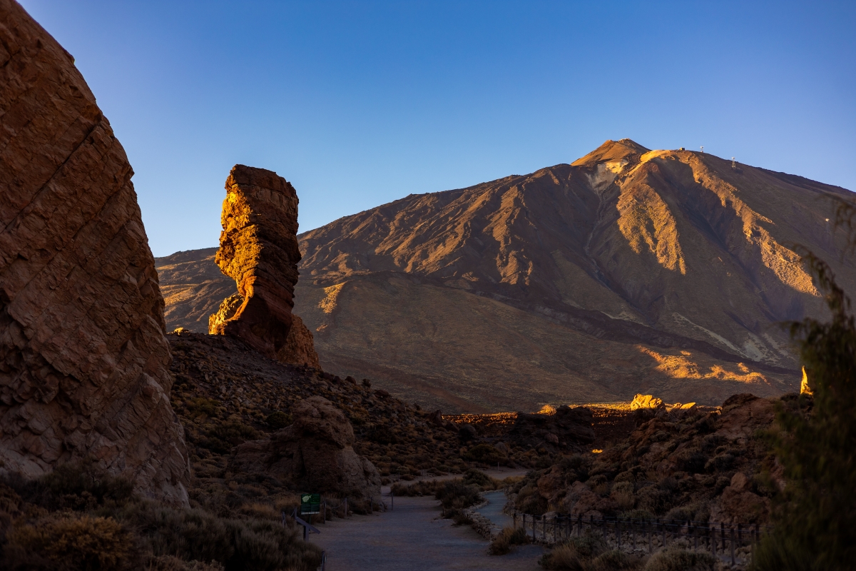
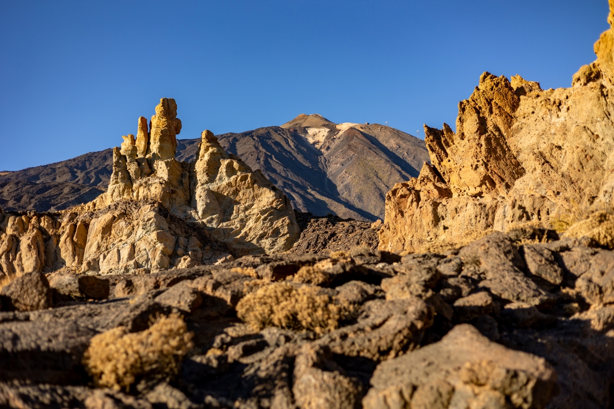
A peaceful stroll through the Cañadas del Teide
There are more than 40 trails to enjoy the Teide and its landscapes, but the Siete Cañadas Trail is one of the most popular. It stands out for its simplicity, gentle slope, and for the 16-kilometre route that takes you past old shepherd settlements, red and blue tajinastes, and picturesque lava flows that trace the history of past eruptions.
The trail begins at El Portillo Visitors’ Centre, crosses the caldera wall of Las Cañadas, and ends at Cañada Blanca Visitors’ Centre.
We recommend wearing comfortable clothing, using sun protection (even if it’s not sunny, UV rays are strong above 2,000 metres), and taking your time. Time to admire the geological formations, local vegetation, and, of course, El Teide in all its grandeur—present throughout the entire walk.
A Gentle Coastal Walk in Southern Tenerife
The route between La Caleta and Playa Paraíso is not just a great chance to explore Tenerife’s southern coast. It also lets you discover some iconic spots of the island’s hippie culture.
Although it’s not marked as a trail, it’s easy to follow. Start in the village of La Caleta, near Costa Adeje where the Princess hotels are located. Walk along the coast heading towards Playa de Los Morteros. From there, climb a small hill with fantastic views of the coast and neighbouring island La Gomera.
Next stop is Diego Hernández cove, a virtually untouched golden-sand beach also known as the “hippie bay”. It used to be the bathing spot of a now-vanished settlement. After your swim at Diego Hernández, pass by El Puertito de Adeje and finish at the tourist area of Playa Paraíso. From there, you can catch a bus back to Costa Adeje or retrace your steps.
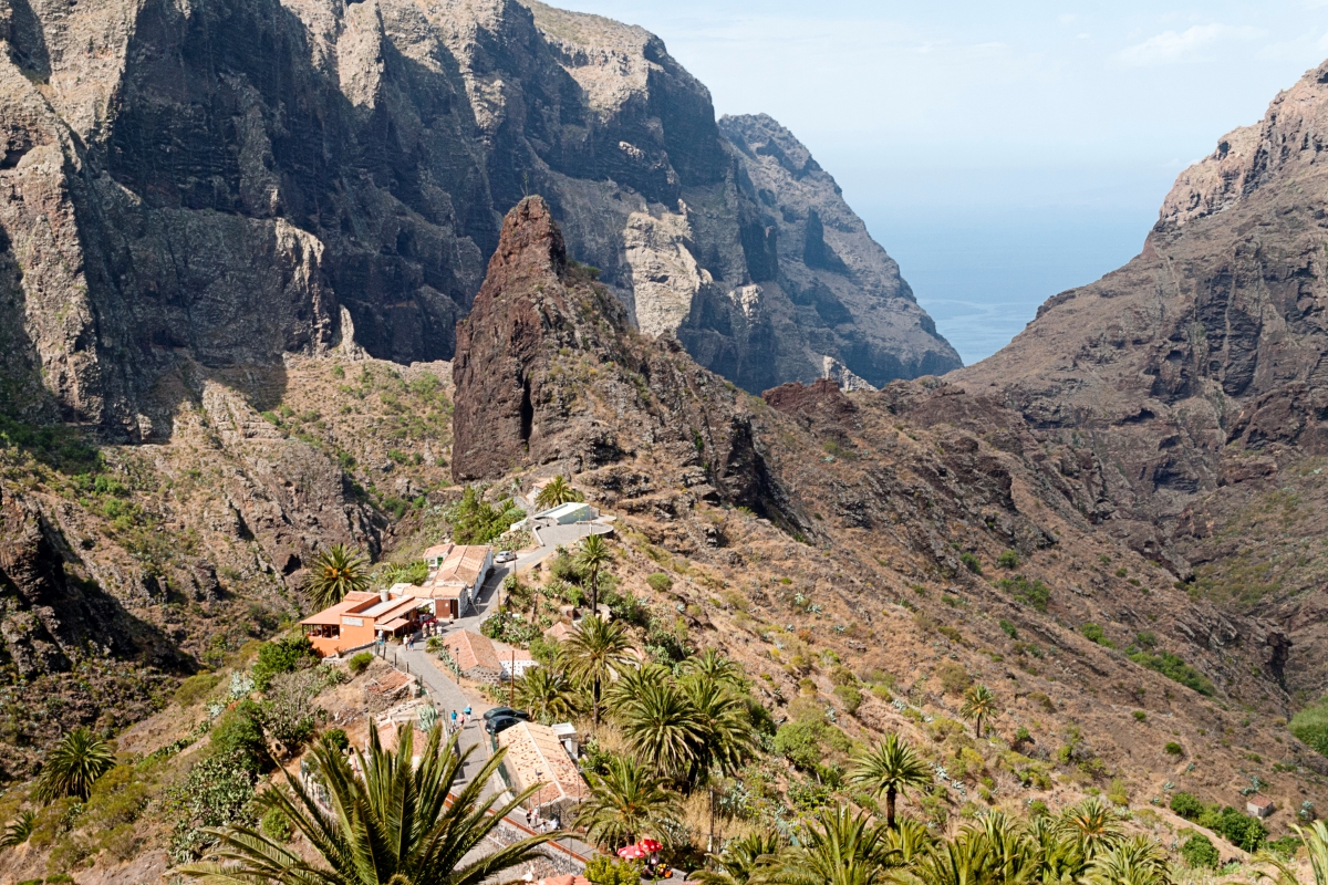
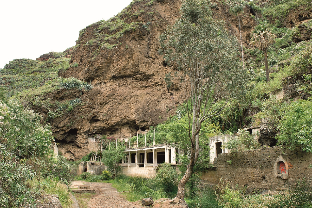
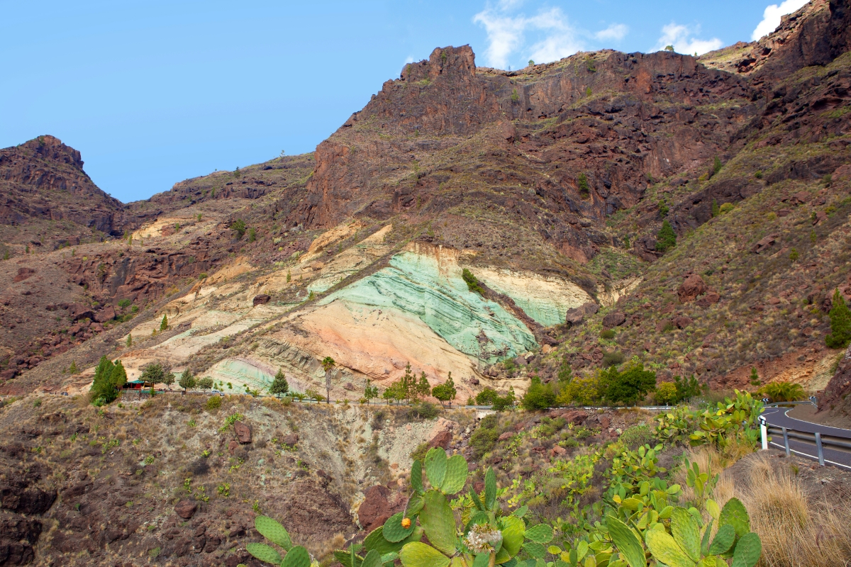
Masca – A Descent Through Lava Walls
The trail through the Masca Ravine is located in the heart of Teno Rural Park. This winding path leads you through a dramatic canyon of volcanic rock walls, ending at a wild black sand beach. It’s not suitable for beginners and requires a reservation to access. Despite its 10 kilometres and seven-hour round trip, Masca is one of Tenerife’s most iconic hikes.
You start your journey at the hamlet, which features classic Canarian architecture. Walk along a trail carved out by water over five million years. Along the way, you’ll enjoy spectacular scenery and delicate, unique flora and fauna. You’ll also witness the passing of time in the multicoloured volcanic strata and the historic traces of goods trading routes.
Lace up your hiking boots for this rocky adventure and marvel at the forest and life that thrives in the vertical stone crevices of Masca.
The Centenary Guardians
In the north of Tenerife, there’s a small trail, little known among tourists but of great scenic value. Known as the Trail of the Centenary Guardians, it’s located in the village of Agua García, in the municipality of Tacoronte.
This circular route runs through Lomo La Jara and passes through a laurel forest. It’s 2.6 kilometres long and takes about 50 minutes. During the walk, you’ll see heather, laurels, orange trees, and fayas—plus its ‘guardians’, viñátigos that are up to 800 years old.
It’s an easy route, particularly recommended for children. The section that runs through the Madre del Agua ravine has been adapted for people with reduced mobility and for the visually impaired.
Hiking in Gran Canaria
Discover the Magic of Tamadaba
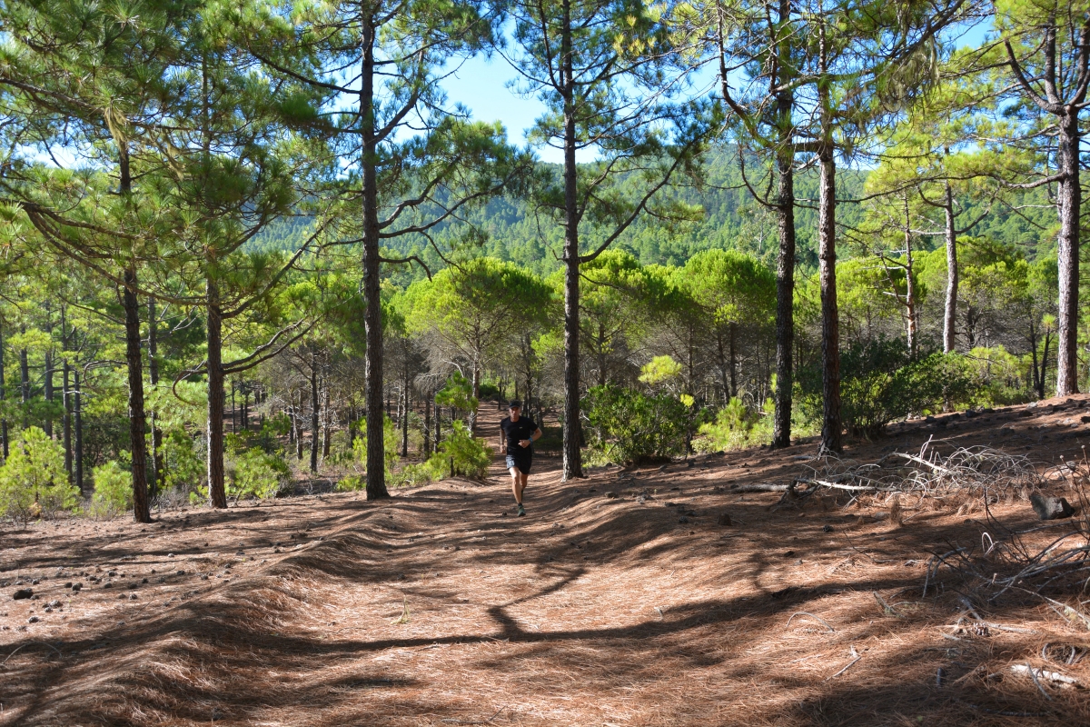
Locals say the best views of Teide aren’t in Tenerife, but in Gran Canaria—and if there’s an idyllic spot to enjoy them in nature, it’s the Tamadaba Natural Park. This vast 7,500-hectare pine forest in the highlands of Gran Canaria is perfect for walking in a truly privileged natural setting.
Tamadaba is a magical place full of trails, but we especially recommend visiting the Llanos del Mimbre viewpoint, where you’ll enjoy spectacular views not just of Teide, but also of northern Gran Canaria. If you dare to explore this vast natural area, be sure to bring food and water—you’ll be surrounded only by pine trees.
Getting to Tamadaba is quite simple. First head towards Artenara, the nearest village, then take the access road to the pine forest. Once there, you can park your vehicle and walk towards the camping area, where the famous viewpoint is located—serving as the starting point for several trails.
Azuaje Ravine – One of Gran Canaria’s Greenest Routes
If you want to breathe fresh air in an enviable natural setting during your holiday, don’t miss one of the island’s most beautiful ravines. This is undoubtedly one of Gran Canaria’s unmissable hiking routes.
The Azuaje Ravine trail is located in the north of the island, between the municipalities of Firgas and Moya. The trail starts at the Firgas bus station. Head towards Las Madres Road (GC-305) and a few metres before reaching the junction with Avenida La Constitución, you’ll see the left-hand turn that marks the trail’s starting point. If arriving by bus, lines 201 and 202 connect Las Palmas de Gran Canaria with Firgas.
The Azuaje Ravine route spans 8.1 km and is a loop that begins and ends in Firgas. It’s ideal for experienced hikers used to high difficulty levels and challenging slopes. It takes about 4 hours. If going with family, we recommend starting from the Azuaje Spa, where the path is easier and there’s a free parking area.
The Gran Canarian Camino de Santiago
Love trekking? Did you know there’s a trail on Gran Canaria that crosses the island from south to north? It’s called the Camino de Santiago de Gran Canaria.
This beautiful 66-kilometre route starts in the island’s south and ends in the northern town of Gáldar. The estimated time to complete the walk is around 23 hours, so we recommend dividing it over two to three days to fully enjoy the breathtaking landscapes and the charming inland villages.
Get ready for a trail full of contrasts: from the sea of dunes left behind in Maspalomas, to the pine forests that paint the island’s heart green, and finally the blue ocean awaiting you at the cliffs of Gáldar.
Gran Canaria Walking Festival
Did you know Gran Canaria hosts an annual festival dedicated to hiking in nature? The Gran Canaria Walking Festival is a public event offering four guided routes through the island’s most stunning landscapes.
Experience the island’s most natural and hidden side. These trails through inland villages let you savour local gastronomy and discover charming corners like rural lodges where you can disconnect surrounded by wild, lush nature.
One of the great advantages of participating in the Gran Canaria Walking Festival is having bilingual expert local guides. Most importantly, you’ll share an incredible experience with fellow hiking and nature enthusiasts.
Each of the four stages includes transport, guides, a picnic, insurance, a snack or tasting lunch, and gifts. Can you think of a better plan to enjoy nature and explore the full charm of Gran Canaria?
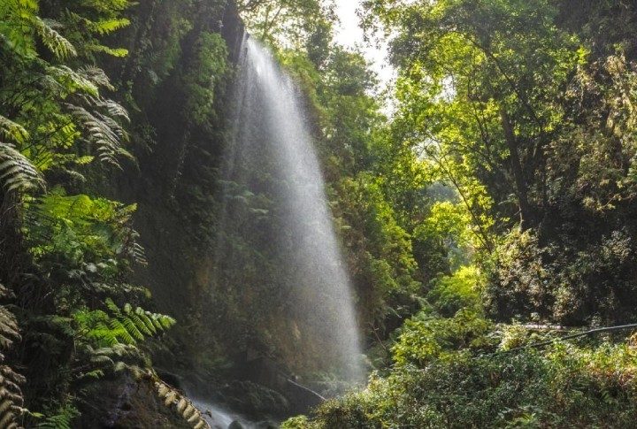
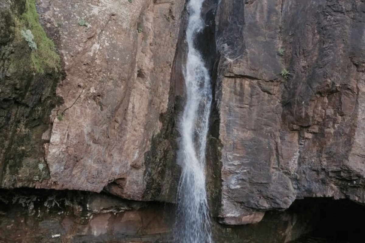
Discover the Waterfall at Charco de Las Palomas
Though waterfalls are rare in the Canary Islands, some are hidden in the rugged terrain. That’s the case with the Charco de Las Palomas waterfall, located in the beautiful village of Tejeda, less than a kilometre from the GC-10 road.
If driving, stop where the road crosses the village’s ravine. The trail runs parallel to the ravine and takes just about 20 minutes. It’s a very easy walk, but it’s possible to get lost—so if you come across a fork, ignore it and continue straight, following the ravine as your guide.
Winter is the ideal time to see the waterfall at its most spectacular. The rains increase the ravine’s flow and make the waterfall even more striking. Its sound is hypnotic, and the little “beach” that forms nearby is a beautiful sight. If you’re brave enough, you can even take a dip—though the water is very, very cold.
Walk Through Ancient Landscapes on the Los Azulejos Trail
The Los Azulejos trail is located in one of Gran Canaria’s most iconic landscapes and is known for sitting in an area with thousands of years of geological history. Starting from the village of Mogán, it offers two different routes: the first is 16 kilometres long, recommended for seasoned hikers, and takes about six hours.
The second route is moderately difficult and covers 1.7 kilometres, taking around 40 minutes. This shorter trail ends at the famous Blue Pools of Veneguera, a set of natural pools deep in the mountains.
It’s worth noting that to do the more difficult route, you need a permit, as it passes through the Inagua Integral Nature Reserve.
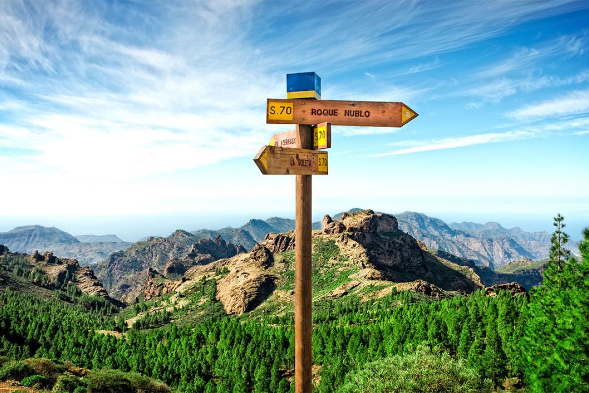
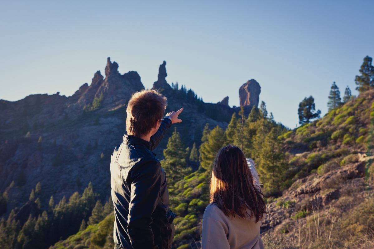
Explore the Magic of Roque Nublo
Have you heard of Gran Canaria’s towering Roque Nublo? This natural monument captivates visitors with its grandeur and mystical allure. This geological icon rises 1,813 metres above sea level and offers breathtaking panoramic views.
If you want to explore this natural treasure, grab your trainers and a cap and hike through its surroundings. Its circular route is about 6.68 km long and of moderate difficulty. It’s a well-rounded walk that lets you experience a variety of Gran Canaria’s natural landscapes.
Start at the Roque Nublo car park or visitor centre, and follow well-marked trails with expansive views. Reach the base to admire its majesty, and, if you wish, climb more challenging sections for even better views—especially of Tenerife’s mighty Teide volcano.
The route also takes you behind the monolith and through rougher terrain before looping back. It’s an unforgettable way to connect with nature and the island’s history.
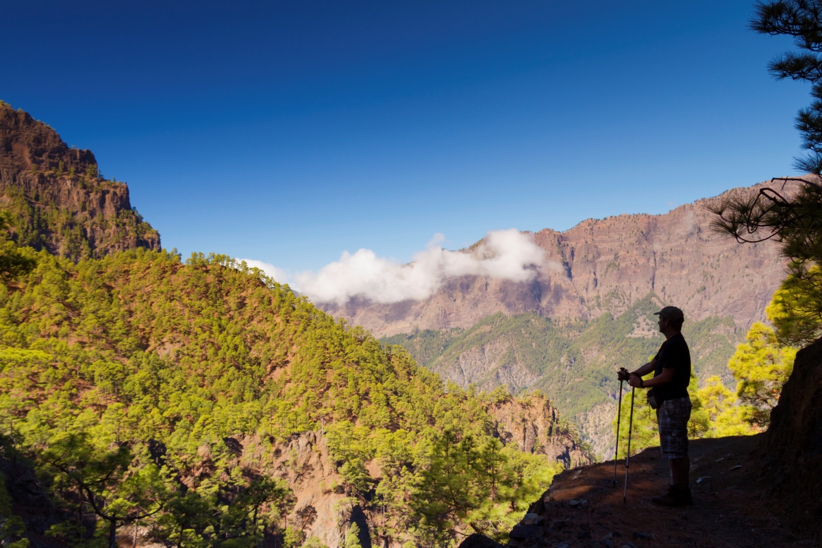
Hiking in La Palma
La Palma – The Island for Trekking Enthusiasts
If there’s one island known for its spectacular trails and scenery, it’s La Palma. The “beautiful island” is synonymous with hiking, laurel forests, ferns, waterfalls, and volcanoes—a land of contrasts that leaves no visitor indifferent.
From north to south, you’ll find routes of varying difficulty. There’s something for everyone, regardless of experience, and all of them are breathtaking thanks to the landscapes they pass through.
The island goes to great lengths to care for its visitors and trekking fans. That’s why all its trails are clearly signposted, and La Palma’s trail network offers all the information you need on its website to help you get started.
The most important thing is to come well-prepared—with enough water and food, sun protection, and a map—so you don’t miss any of the most interesting spots along the way. Lace up your boots and pack your rucksack—the beautiful island is waiting to amaze you!
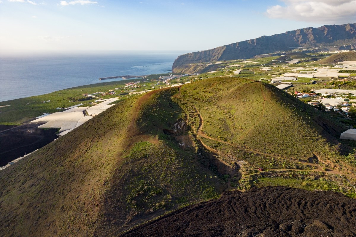
Discover the Impressive Volcano Route in La Palma
The Volcano Route is one of La Palma’s most iconic trails—an unmissable journey for nature lovers and adventure seekers.
Recently reopened following the eruption of the Tajogaite volcano, the route highlights the island’s striking landscapes and the historical significance of its volcanic past.
Spanning 22 kilometres, the trail runs through the municipalities of El Paso, Mazo, and Fuencaliente. It also crosses the Cumbre Vieja Natural Park, passing close to the new volcano, which is visible from certain sections. The route includes forest paths, trails, and paved stretches, and can be completed in six to eight hours at a leisurely pace.
The route can be walked in either direction. Start from the Fuencaliente lighthouse for a steep climb—like the runners of the Transvulcania do—or set off from the Refugio del Pilar in El Paso and end at the lighthouse near La Palma Princess Hotel.
Step into the Heart of La Palma
La Caldera de Taburiente is an impressive geological formation in La Palma—a massive volcanic crater about 8 kilometres wide and 1,500 metres deep, surrounded by towering mountains and lush vegetation. This national park is a must for nature and hiking enthusiasts.
There are several routes through La Caldera, depending on your ability and the time you want to spend. One of the most popular starts at the La Cumbrecita car park (entrance to the national park) and ends at the Cumbrecita Viewpoint. This 6-kilometre trail takes around 3 hours and is of medium difficulty.
Another great option begins at the El Paso Visitor Centre and descends into the caldera itself. This tougher route is about 16 kilometres long, takes roughly 6 hours, and offers stunning views of volcanic landscapes and native vegetation.
For a shorter option, try the walk from Los Brecitos Refuge to the Cumbrecita Viewpoint. This trail is 4 kilometres long, lasts around 2 hours, and is low in difficulty. In short, La Caldera de Taburiente is a spectacular and magical place, offering a unique nature experience.
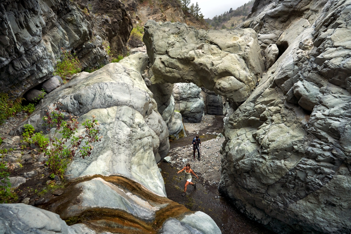
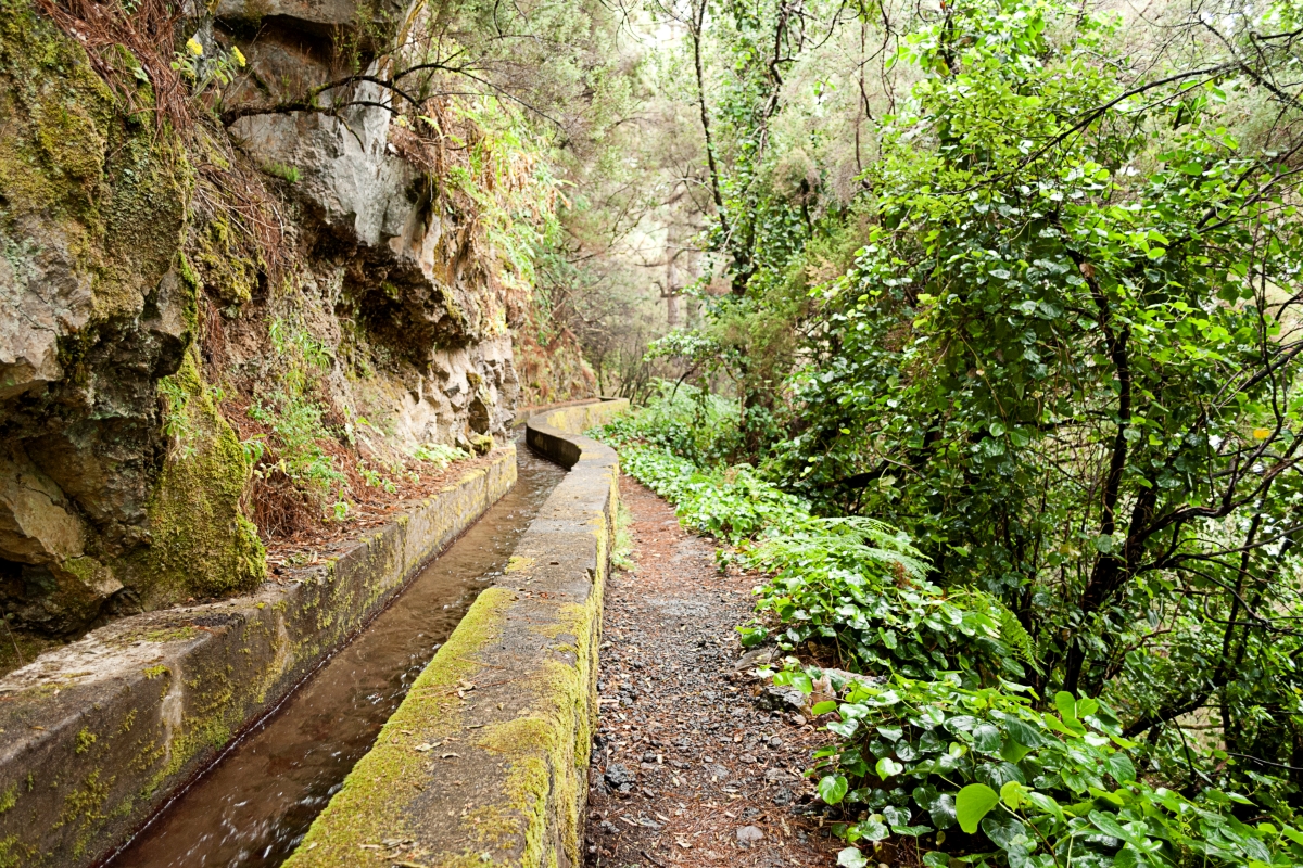
Go Hiking in the Unique Landscape of Marcos and Cordero, La Palma
La Palma boasts incredible beauty, with scenery and trails that are musts for nature lovers. One of the highlights is the Marcos y Cordero trail, where water is the main feature.
The path lies deep in the Los Tilos forest, home to the island’s most important natural water springs. It includes thirteen tunnels stretching from the Casa del Monte to the Marcos and Cordero Springs.
This route is aimed at experienced hikers, with a length of 13 kilometres, a 1,000-metre elevation gain, and an estimated duration of 5 hours. A torch and raincoat are highly recommended, as parts of the route pass through wet tunnels.
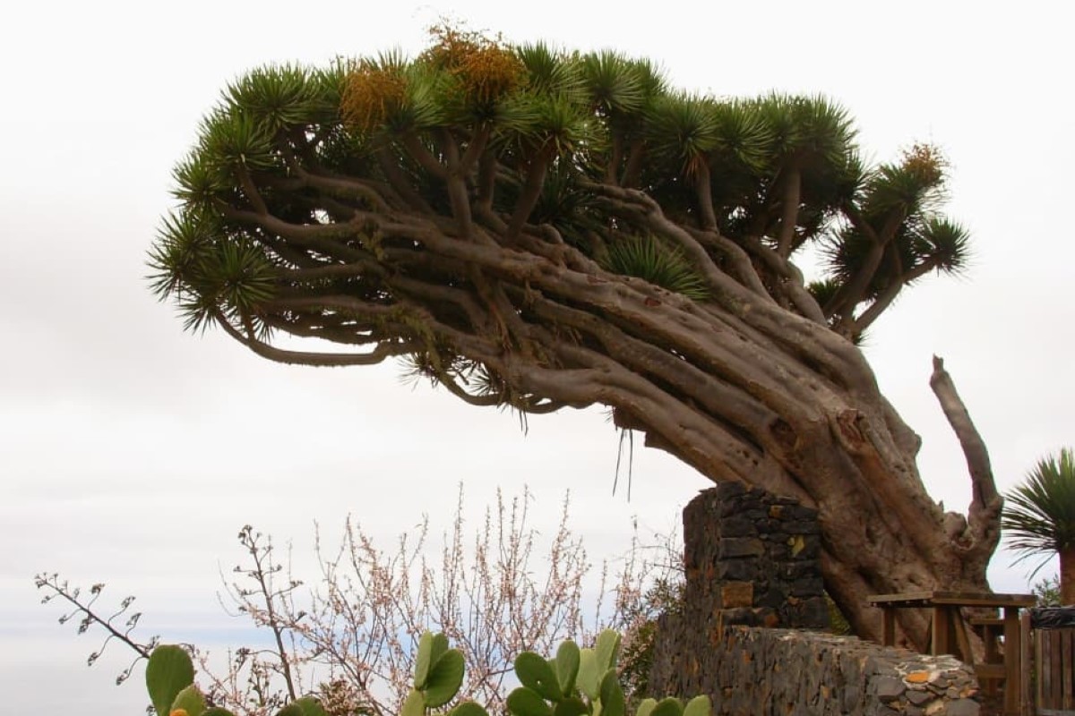
The Dragon Trees of Buracas
The Dragon Trees of Buracas are considered one of the must-see trails if you visit the Isla Bonita. Along the way, you’ll find the highest concentration of these native Canarian trees.
Located in the municipality of Garafía, in the island’s north, there are two ways to do the trail. For intermediate-level hikers, the best option is the circular route starting in Las Tricias village, 6 kilometres long and lasting two to two and a half hours.
The second option is perfect for families. This trail begins at the Gofio Interpretation Museum and takes about 20 minutes.
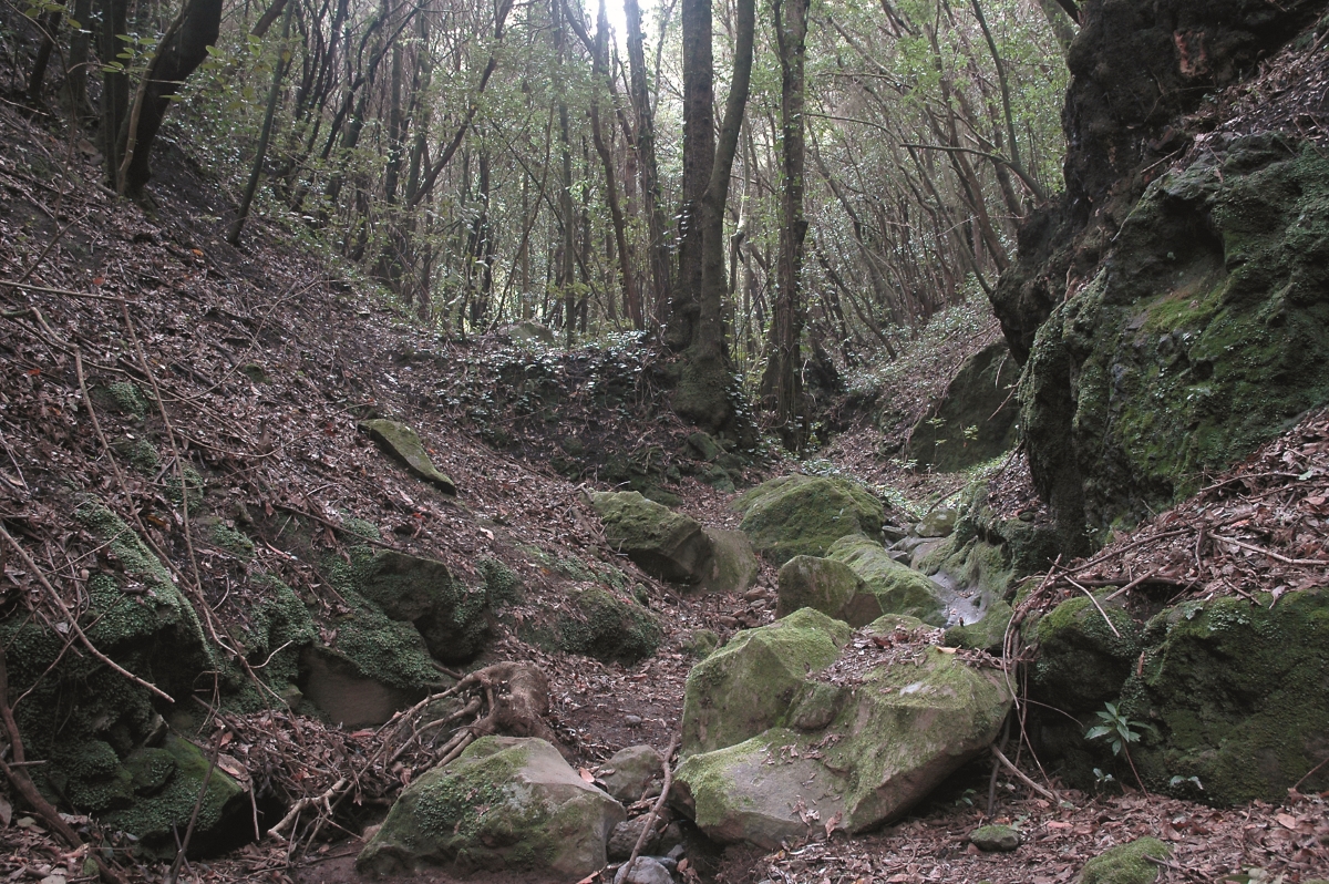
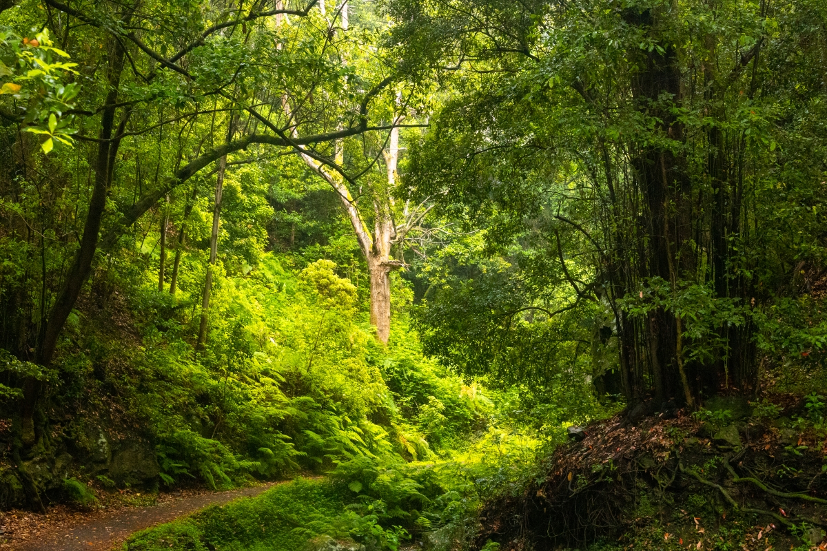
Discover the Magic of the Canary Laurel Forest
The island known as the “Isla Bonita” is one of the greenest in the Canary archipelago. If you want to experience magical trails, one must-see hike is Cubo de la Galga. You’re guaranteed to be amazed!
Located in the Las Nieves Natural Park, this area feels like stepping into a tropical jungle. It’s one of the best places on earth to enjoy the freshness of the laurel forest—a humid subtropical ecosystem that dates back to the Tertiary period, over 20 million years ago. You’ll encounter trees like laurel, viñátigo, and heather, as well as mosses and lichens. The richness of its vegetation and natural beauty led Cubo de la Galga to become La Palma’s first Biosphere Reserve.
This self-guided circular trail is 11 kilometres long and takes around four hours. The walk is suitable for the whole family, though there are also more challenging options for advanced hikers. Be sure to stop by the Environmental Information Point, where the trail begins, for all the essential details.
Categories: Canaries, Travel Tips


Leave a Comment