


Discover Fuerteventura with these five hiking routes
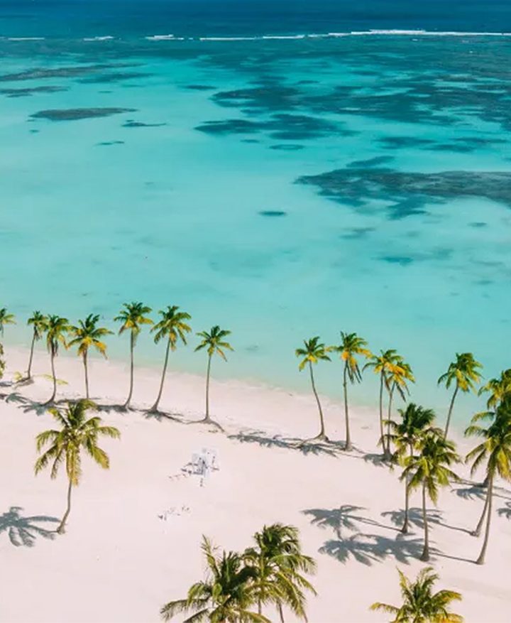
When we think about Fuerteventura as a holiday destination we tend to think about its white sand and turquoise water, sun and beaches. However, the island also conceals some spectacular lunar landscapes between craters, dunes and cliffs. It’s a dream location for hiking.
Discover all the island’s striking contrasts on these five hiking routes, all recommended by Princess Hotels & Resorts. Be captivated by the island’s energy!
Explore Fuerteventura through its hiking trails
Its nature: Fuerteventura is by extension the second Canary Island and the oldest, with almost 22 million years of history. It is characterised by its soft reliefs, its lush vegetation and its unique beaches! Its protected spaces are one of the island’s main attractions. Declared a UNESCO Biosphere Reserve in 2009, it boasts 13 natural parks with different degrees of protection that will delight you.
Trail surface: The island is predominantly flat, making it ideal for planning easy and beautiful walks with the family. There are also some areas that stand out due to their altitude, for example, in the central area of the Betancuria massif sits the peak of La Atalaya, which stands at 724 metres high. In the south lies the Jandía Natural Park where the island’s tallest mountains are; Pico de la Zarza is the highest at 807 metres.
Hiking for all: Fuerteventura offers a vast network of hiking trails for all levels, from beginner to expert. Discover the beautiful stretches of coastline with their white sandy beaches or head into the mountains and admire the fascinating landscape with its unique spurge plants. Whichever route you choose, an unforgettable experience is guaranteed.
Climate and temperature: The Canary Islands have a subtropical climate and little rain throughout the year. You can enjoy hiking at any time of the year.
The Calderón Hondo volcano: the majesty of nature
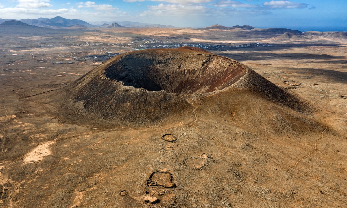
Calderón Hondo, also known as the ‘young volcano’. It is one of the island’s best-preserved craters, and it is estimated that it started erupting some 50,000 years ago. To discover its grandeur, we propose taking the circular path (SL-FV-2), adapted to all levels.
A walk around the volcano: This route starts and finishes at a parking space on the outskirts of Lajares, heading towards Majanicho. Follow the path that leads clockwise around the volcano and be rewarded with a breathtaking panorama that unfolds before you. Gaze upon the sprawling expanse of Corralejo, the nearby island of Lobos, and even the distant shores of Lanzarote. About halfway along the path, a viewpoint offers a dramatic glimpse deep into the crater.
The wildlife: Despite their undeniable cuteness, Barbary ground squirrels are not native to Fuerteventura and pose a threat to the island’s unique ecosystem. Introduced in 1965 as pets from North Africa, their population has thrived. Now a common sight, these squirrels can even be found around Calderón Hondo. As you hike, you might spot a variety of bird species soaring through the air. With a little luck, you could even catch a glimpse of the majestic Canarian crow, a bird native to the archipelago. The landscape itself is a testament to resilience. Look closely and you’ll discover plant species that have ingeniously adapted to thrive in these arid conditions.
Planning your adventure: It’s an easy hike that is well signposted. Here you can find more information on the route.
A culinary reward: After the 1.5-hour hike, reward yourself with a taste of the Canary Islands. Head to “Los Pinchitos” on Lajares’ main street, where you can savour the island’s culinary scene. Sample the region’s famed Majorero cheese, indulge in the rich flavours of “chevon with garlic,” or tempt your taste buds with homemade croquettes.
Practical information:
- Duration: 1.5 hours
- Distance: 5 km
- Difficulty level: low
- Type: circular
- Elevation: 160 metres
- Starting point: Parking Calderón Hondo, Lajares
Gran Valle-Playa de Cofete: a dream-like landscape
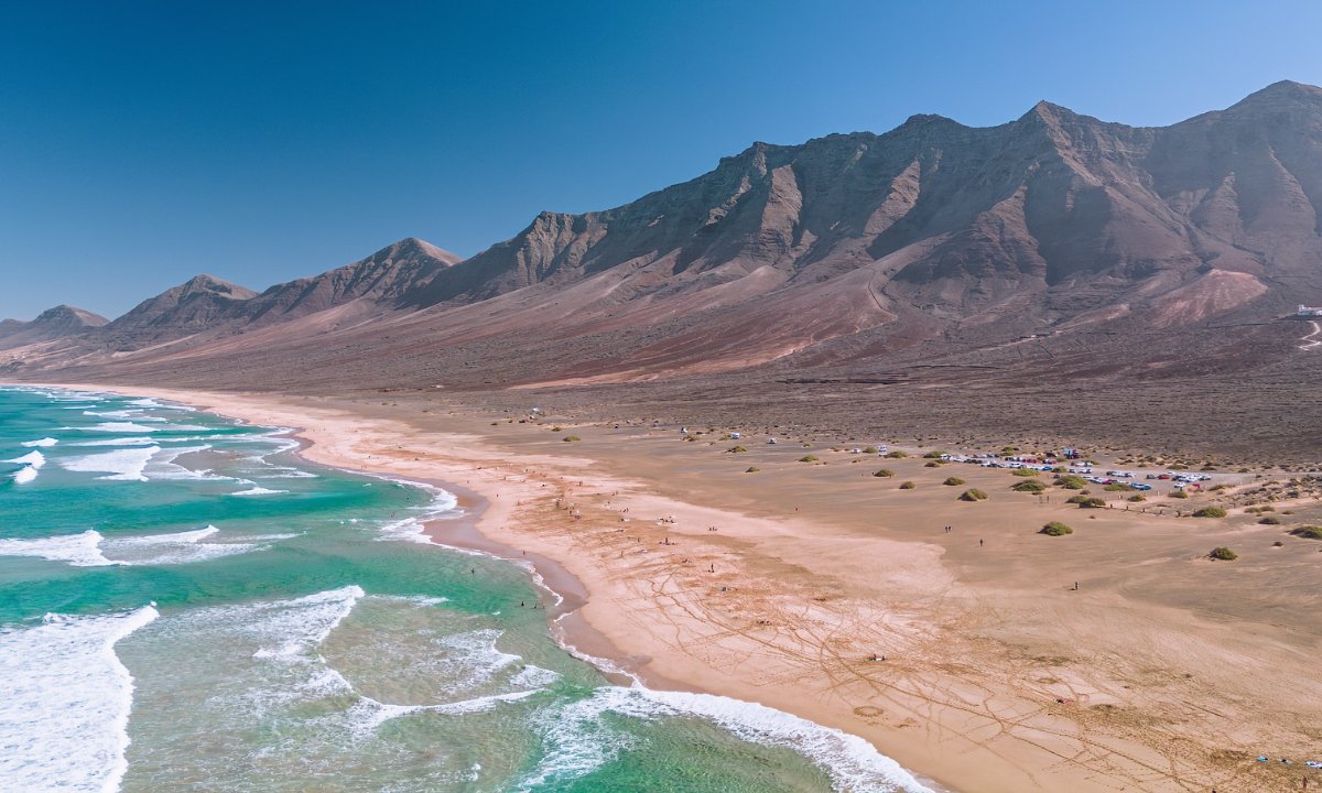
In the south of the island, this trail is unique for its outstanding natural and wild beauty. You’ll discover the Jandía Natural Park up close and enjoy some magnificent views of the surrounding mountain peaks. You can also find remains from the island’s former settlers, unique fauna and the endemic Jandía cardon (Euphorbia handiensis). Also known as the “hairy cardon,” this cactus-like species is sadly facing the threat of extinction.
From Gran Valle to Cofete: Your adventure begins in the heart of Gran Valle a picturesque valley leading you towards the acclaimed Cofete beach, considered one of the best in Spain. The initial stretch of the route winds through a captivating landscape dotted with “cardones” and “tabaibas,” unique plant life endemic to the Canary Islands. As you progress, prepare to be awestruck by the panoramic vistas from the Mirador de Cofete viewpoint. Situated at the Degollada de Agua Oveja pass, 234 metres above sea level, this vantage point offers breathtaking views that will leave you speechless.
A culinary reward: after this tour, we recommend you try the traditional food at the only restaurant in the area. It is the Cofete Pepe El Faro Restaurant, open from 10 am to 5 pm every day.
Practical information:
- Duration: 2 hours and 30 minutes
- Distance: 6.40 km
- Difficulty level: moderate
- Type: there and back
- Elevation: 370 metres
- Starting point: Gran Valle, Gran Valley bus station
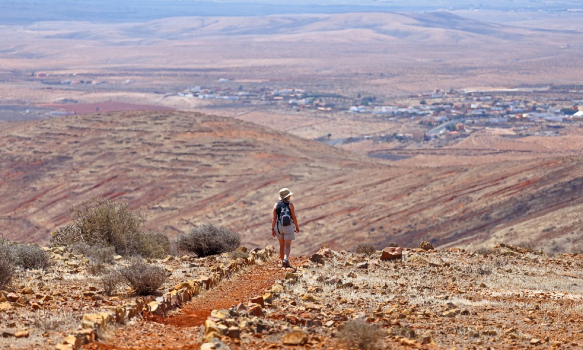
Incredible views from Pico de la Zarza
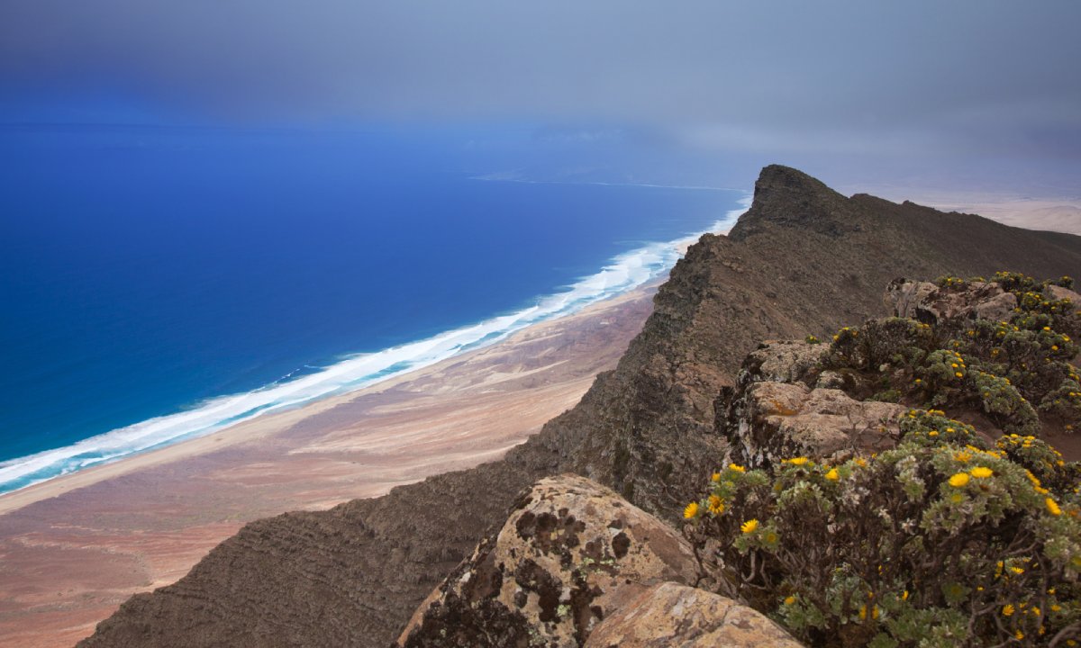
One of the best views of the island is to be found in Jandía. Specifically, at Pico de la Zarza, at an altitude of 807 metres. The road is well signposted, so you won’t get lost. Please note that the strong wind in the area can make it feel much cooler, so make sure you take some warm clothing.
At the top of Fuerteventura: along the trail you can observe the change in landscapes as you ascend, until you reach the peak of La Zarza. Here you’ll be rewarded with an incredible panoramic view of Cofete Beach.
Its diverse fauna: on this route you are likely to cross paths with a cabra majorera (Fuerteventura goat) roaming freely or spot specimens of the common buzzard. You can also appreciate the island’s local flora, such as the ‘Tajinaste de Jandía’ (Echium handiense) or the Canary Island daisy.
Planning your adventure: if you want to take this route with a guide, remember to book in advance with one of the companies that organise this type of experience.
Practical information:
- Duration: 4.5 hours
- Distance: 13 km
- Difficulty level: low
- Type: there and back
- Elevation: 694 metres
- Starting point: Departs from Morro Jable, above the Lugar Vinama water reservoir
El Barranco de Las Peñitas: the charm of Fuerteventura
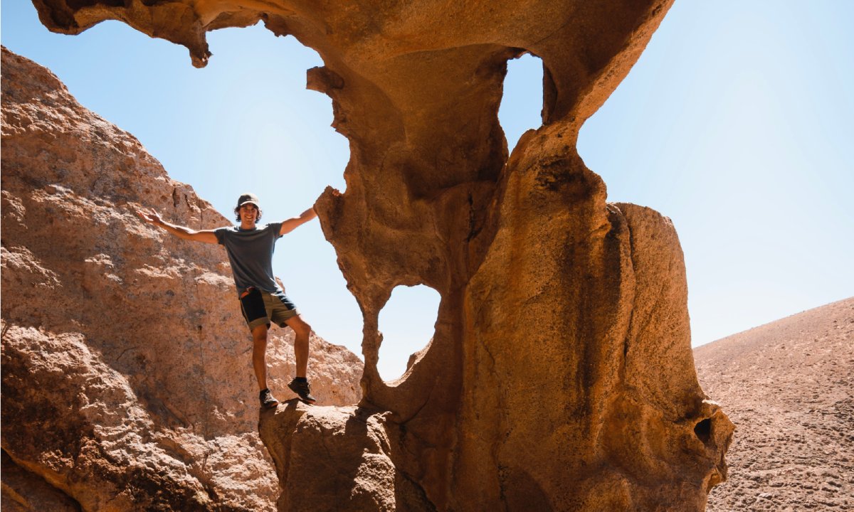
El Barranco de Las Peñitas is one of the most popular enclaves on Furteventura. It is located in the Betancuria Rural Park, a protected natural area. Its characteristic name is due to its relation to the dam built in 1937, one of the few remaining on the island.
A family friendly adventure: It’s short and easy path makes it possible for walkers of all levels to undertake. It starts in the municipality of Pájara, in Buen Paso, characteristic for its palm trees, and runs to the chapel of the Virgen de La Peña. At the end of the route, we will reach the dam at Las Peñitas. The route can be circular or, if you prefer, you can climb up to the Arco de Las Peñitas rock.
Enrich your experience with a visit to the nearby village of Vega de Río Palmas. This quaint little village offers a glimpse into the local culture and is located close to both the start and end point of the hike.
Planning your adventure: On the route, to your left, you will see a small dry stream. The path is well signposted so there’s no chance of losing your way. For a truly unforgettable experience, take a short 5-minute drive from Vega de Río Palmas to the Mirador del Risco de Las Peñas and be rewarded with stunning panoramic views.
Practical information:
- Duration: 2 hours
- Distance: 3.5 km
- Difficulty level: low
- Type: there and back
- Elevation: 108 metres
- Starting point: Buen Paso
You’ll love the ravine Los Enamorados
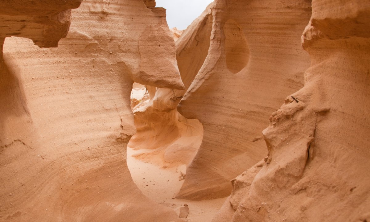
As the name suggests, the Barranco de Los Enamorados (or the enchanted ravine) will leave you with a lasting impression. This geological formation is unique in Fuerteventura. It is a volcanic cone of about 100 metres high and over ten thousand years old. It is formed of black rocks, which contrast with the white of the fossil dunes.
Its surroundings: of great scenic value, it is considered an Asset of Cultural Interest. On its walls you can find marine and terrestrial fossils. It owes its name to the magical effect that occurs when sunlight hits the dunes. The colour changes according to the time of day, resulting in a magical effect.
The hiking path: you can visit the volcano via two routes: from El Cotillo or El Roque. Both paths end at the Esquinzo Beach. From there, you can walk around the volcano and enjoy incredible views of the ravine and the sea. The route, which is around four kilometres, has a low difficulty level, so it is suitable for families with children or the elderly.
Practical information:
- Duration: 49 minutes
- Distance: 4 km
- Difficulty level: easy
- Type: circular
- Elevation: 120 m
- Starting point: El Cotillo or El Roque
And don’t forget to bring suitable clothing and footwear, coat, sun protection, cap, water and something to eat. Enjoy an adventure in Fuerteventura!
Categories: Canaries, Fuerteventura, Get Inspired, Lifestyle


Leave a Comment