


Hiking Adventures in Tenerife: Find Your Perfect Trail
Tenerife whispers its secrets to those who explore its diverse landscapes on foot. Hike through volcanic wonders, witness dramatic changes in climate and scenery, and encounter the island’s remarkable flora and fauna.
Discover all the island’s striking contrasts on these 5 hiking routes, all recommended by Princess Hotels & Resorts.
Each route gives you the chance to connect with the very essence of Tenerife. Feel the fresh breeze on your face, the sun on your skin and the sound of your steps pounding the earth.
Let nature show you the way, and immerse yourself in a unique experience.
Discovering Tenerife on foot: an island of contrasts and unique experiences
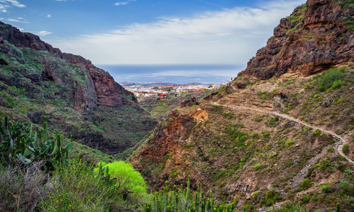
Volcanic origins: Tenerife’s volcanic origins date back a staggering 12 million years-plus, resulting in a wealth of diverse nature and striking contrasts. The unique landscapes and geological features shaped by eruptions and erosion really are awe-inspiring.
Microclimates and diversity: The island is home to a variety of microclimates thanks to its high altitude, with Teide towering 3,715 metres into the sky. As you ascend from the coast, passing from the midpoint up to the summit, you’ll notice the constantly changing temperatures and landscapes. The fresh and humid trade winds also have an influence on the island, creating the perfect conditions for vegetation and spectacular landscapes to flourish.
Hiking for all: When you’re walking in Tenerife, you’ll find a vast network of paths for all levels, from beginner to expert. Traversing the lush forests of the north, discovering exotic species in the south, walking between the Canary Island pine forests in high-altitude areas and taking in the other-worldly volcanic landscapes of Teide. It’s all there for the taking. Whichever route you choose, an unforgettable experience comes guaranteed.
Climate and temperatures: Pleasant temperatures are a given all year round, thanks to the winning combination of the Canary Islands’ subtropical climate and Tenerife’s microclimates. Aside from a few high-altitude exceptions to the north of the island, temperatures rarely fall below 20°C.
Barranco del Infierno: Heavenly hike in Tenerife’s Hell’s Gorge
A somewhat unfortunate name for an idyllic haven: The Barranco del Infierno Nature Reserve, located in Adeje might well come with an intimidating name. But don’t let that put you off! It’s a haven of stunning beauty and diversity. The name comes from the steep slopes of the rocks and ravines, but the Barranco del Infierno is more heaven than hell: an oasis of unspoilt nature that will take your breath away.
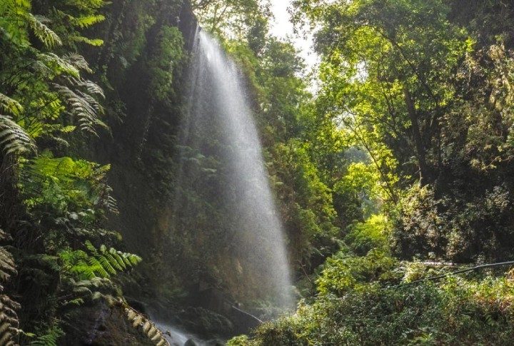
Journeying through the altitudes: You’ll go from 350 metres above sea level to an altitude of 1,300 metres, giving you the chance to take in constantly evolving panoramic views. The path narrows as you enter the ravine, leading you to an impressive 200-metre waterfall. To witness the waterfall at its most impressive, consider visiting during the island’s times of higher rainfall, typically between November and April.
A unique ecosystem: The Barranco del Infierno is home to a huge variety of flora and fauna, boasting more than 456 different species. You’ll come across native species such as ‘cardones’ (giant cacti), ‘tabaiba’ (a native species of Euphorbia), Canary Island dragon trees and ‘espineros’ (Rhamnus crenulata) in the thermophilic forest. And when you’re 600 metres above sea level, you’ll also get great views of the majestic Canarian pine trees. As for the fauna, you may well catch a glimpse of ravens, sparrowhawks, and even owls at sunset.
Planning your adventure: If you want to visit the ravine, you need to book your ticket in advance: access is restricted to a maximum of 20 people. You can find more information and look up prices on the official website.
A delicious finish: When you’ve finished your walk, you’ll be ready for something to eat. Don’t miss your chance to sample a famous Adeje dish: Adeje chicken (pollo de Adeje). Otelo restaurant is right next to the start of the trail, so you can sample this unique delicacy as you take in stunning views of the ravine.
Practical information:
- Distance: 6.07 km.
- Duration: 3-4 hours.
- Difficulty level: medium-low
- Best time of year to go: autumn and winter.
- Elevation: 990 metres.
- Route: there and back.
- Parking: there’s a parking area
- Our advice: wear footwear suited to slippery terrain
- No swimming allowed in the waterfall.
- Make sure you take enough food and water to last you for the route.
Our two hotels, Guayarmina Princess and Princess Inspire Tenerife, are located just 7 km from the starting point of this route (approximately 15 minutes by car).
Sendero de los Sentidos: a sensory journey through the heart of Anaga
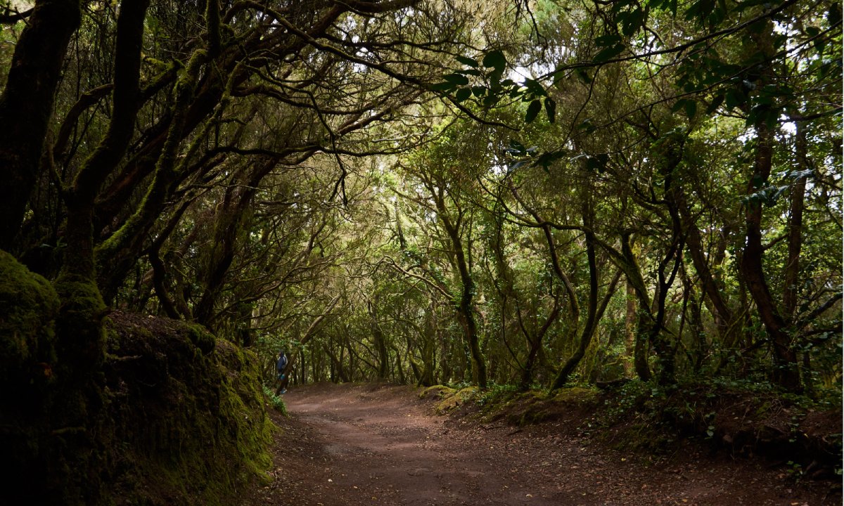
Discover Tenerife’s natural paradise: The Sendero de los Sentidos (The Path of Senses) is located in Anaga Rural Park. Designated Biosphere Reserve status since 2015, this unique route takes you through one of the island’s most beautiful enclaves.
Three trails, one experience: Dive into a sensory journey through three interconnected paths. Walk through the laurel forests, discovering the unique fauna and getting deeper into nature with every step.
Accessibility for all: Trail 1 is designed for people with reduced mobility, giving everyone the opportunity to enjoy this experience. Trails 2 and 3 take you to the heart of the laurel forest, one of the natural treasures of Tenerife and wider Canary Islands.
Start your adventure: All the trails start from thee Cruz del Carmen, where you’ll find a visitor’s centre. Here, you can get more information on the area and prepare yourself for an unforgettable adventure.
Practical information:
- Distance: 1 – 340 metres, 2 – 540 metres, 3 – 1.27 km.
- Duration: 1 – 10 mins, 2 – 15 mins, 3 – 30 mins.
- Difficulty level: 1 – very low, 2 – very low, 3 – low.
- Best time of year to go: anytime.
- Elevation: 1 – 6 metres, 2 – 20 metres, 3 – 100 metres.
- Route: 1 – There and back, 2 – circular route, 3 – circular route.
- Our advice: the temperatures can drop, so make sure you’ve got the right outerwear
Sendero de Guajara: discover the magic of Teide from the summit
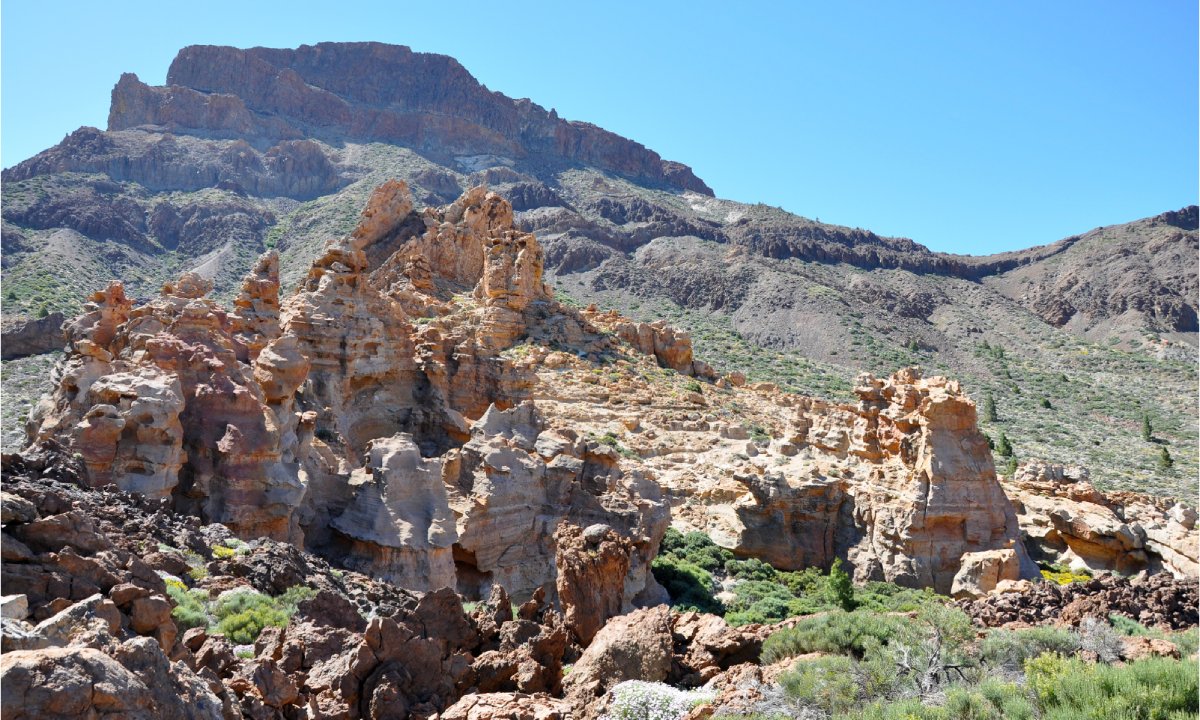
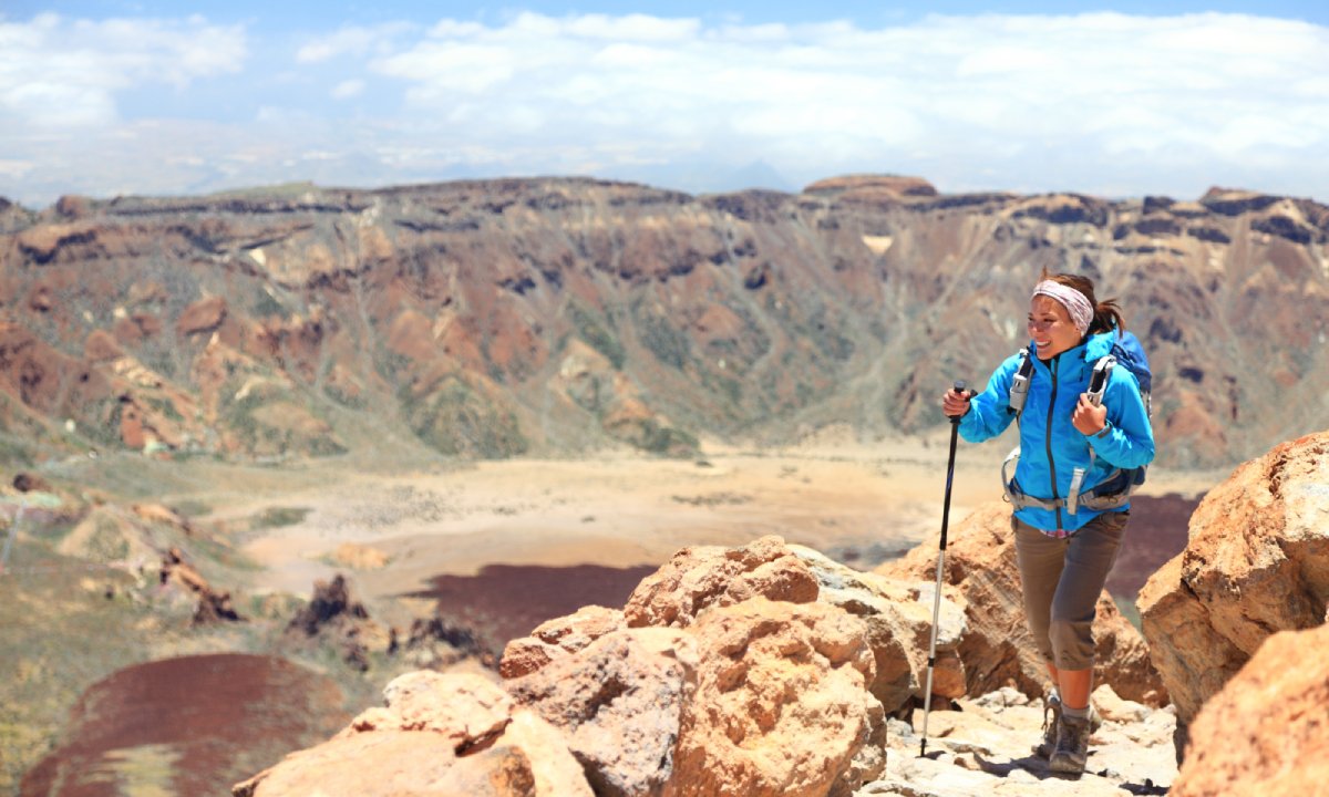
Conquer the third-highest summit in the Canary Islands: The circular Sendero de Guajara route takes you up to an altitude of more than 2,700 metres, giving you the chance to see the true magic of Teide National Park.
A challenging route, with an incomparable reward: This route may be harder than others, but it’s worth it. Your final reward? A 360-degree panoramic view guaranteed to leave you spellbound. From the top, you’ll see how vast the island of Tenerife really is, with its volcanic peaks and vast landscapes extending all the way to the horizon.
A celestial viewpoint: When you get to the top, Guajara offers breathtaking views of the island. Not to mention the night sky – which is probably why it was considered a sacred place by the ancient ‘guanches’. It’s no coincidence that the world’s first mountain astronomical observatory was built here in 1856 by the astronomer Charles Piazzy Smyth.
Two options, one adventure: You can choose between two routes on the Sendero de Guajara:
- Route 1:This path starts at the Cumbres de Ucanca and takes you to the Parador de Las Cañadas del Teide, covering a distance of 5.5 km and an elevation of 840 metres. On this route, you’ll get a closer look at Teide.
- Route 2:This one follows the Siete Cañadas trail and ends at the Parador, covering a distance of 7.5 km and an elevation of 1,200 metres. This route gives you a greater variety of landscapes, including the Siete Cañadas, an impressive range of volcanoes.
A journey loaded with history: As well as panoramic views, the Guajara hike serves up a dose of the island’s rich history and culture. As you walk, you’ll come across petroglyphs (stone carvings) left by the ‘guanches’; Tenerife’s original inhabitants.
Cruz del Carmen – Punta del Hidalgo: a journey full of contrasts
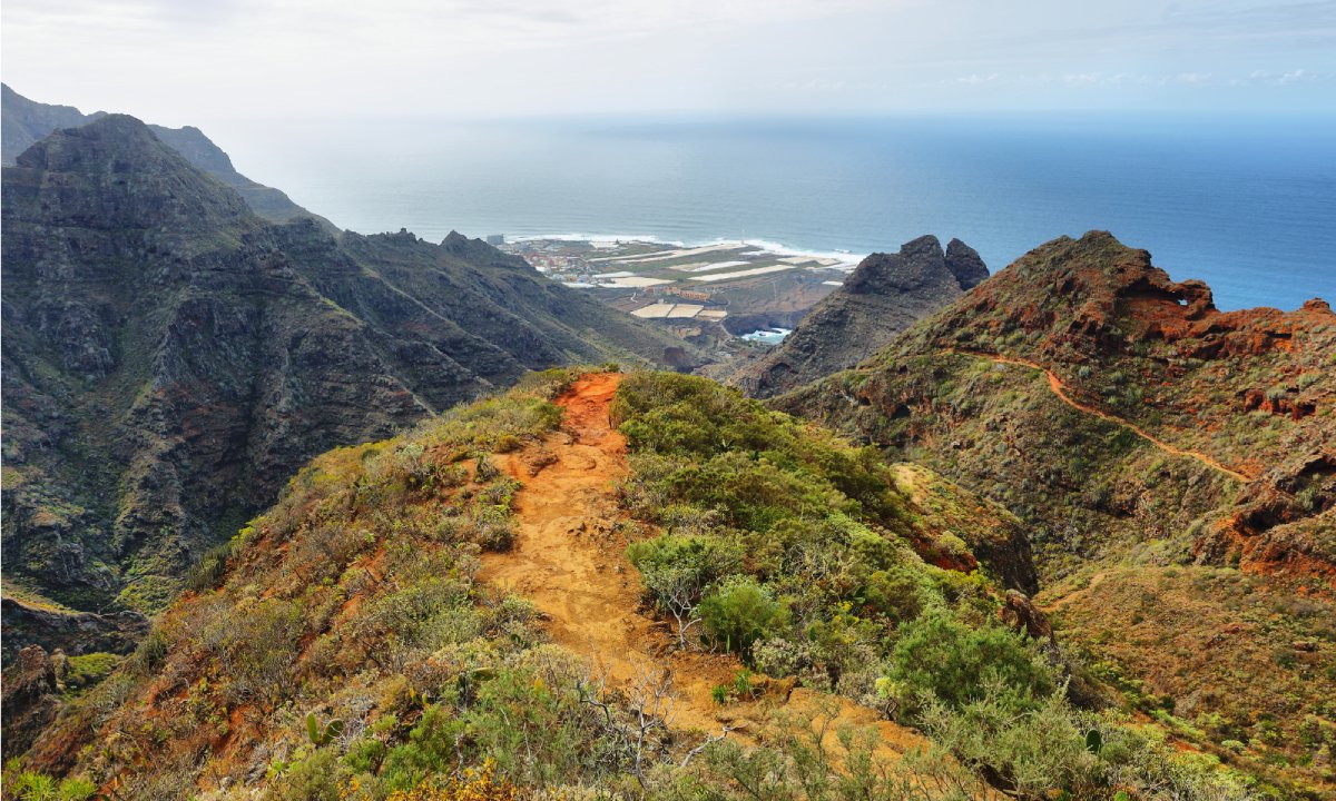
Discover the diversity of Tenerife: If you’re looking for somewhere that shows you the full variety of landscapes the island has to offer, the path linking Cruz del Carmen with Punta del Hidalgo is the one for you. This 10-kilometre route is divided into three stages (differentiated by altitude), showing you Tenerife’s natural riches from different perspectives.
Stage 1: Plunge deep into the laurel forest: The first stage takes you from Cruz del Carmen to Las Carboneras, where you’ll enter a lush laurel forest. Immerse yourself in this fresh, humid and altogether unique ecosystem, home to a wide variety of native flora and fauna. The laurel forest is an official UNESCO World Heritage Site.
Stage 2: A trip through rural Tenerife: The second stage introduces you to the most rural side of Tenerife. You’ll traverse agricultural land until you reach the area of Chinamada, where you can savour stunning panoramic views of the island. The blend of traditional life and nature creates a unique landscape.
Stage 3: Descent to the coast, and a quick dip: On this last stage you’ll go down a path flanked by thickets, until you reach the coast in Punta del Hidalgo where you’ll find the famous lookout point. Lose yourself in views over the Atlantic Ocean, then top off your adventure with a refreshing dip in the natural swimming pools. They are ideal for a spot of swimming and snorkelling.
Practical information:
- Distance: 10 km.
- Duration: 4 hours.
- Difficulty level: average.
- Best time of year to go: any time of year.
- Elevation: 600 metres.
- Route: linear.
- Our advice: bring the right kit: you’ll need decent footwear, suitable for the descent, as well as food and drink. And don’t forget your hat and sunscreen!
Ruta de los Guardianes Centenarios: a magical trip through Tacoronte
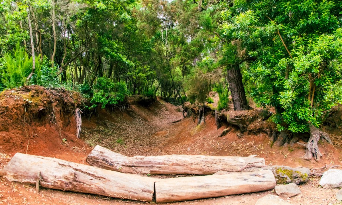
Dive into your own Tenerife fairy tale: The Ruta de los Guardianes Centenarios (Centenary Guardians Route) in Tacoronte takes you on a magical journey through an enchanted forest. You’ll be utterly captivated by the charms of the majestic, centuries-old ‘viñátigo’ trees; a species native to the Canary Islands dating back 800 years that will take you back in time. The Ruta de los Guardianes Centenarios is also part of Anaga Rural Park.
A trip through flora and time: As you make your way along the route, you’ll discover a host of ancient tree and shrub species, including heather, lime, Ilex canariensis, fire trees and laurels. You’ll cross bridges and caves including the Cuevas de Toledo where materials for glass were extracted in the olden days, giving you a tangible connection to the island’s past.
A walk with breathtaking views: Start your adventure at the Patrimonial de Agua García Information Centre, and ascend until you reach the Lomo de la Jara picnic/play area, where there’s a viewpoint giving you impressive views over Tacoronte Valley. And when the mist so typical of the area descends and envelops the landscape, it’s an even more magical experience.
Practical information:
- Distance: 5 km.
- Duration: 3 hours.
- Difficulty level: low.
- Best time of year to go: any time of year.
- Elevation: 290 metres.
- Route: circular.
Walking in Tenerife gives you the chance to discover a whole new world: This guide has given you a taster of the most fascinating walks, but it barely scratches the surface. The island is dotted with an infinite number of routes for all levels and tastes, all ready to serve up unrivalled experiences.
Discover the magic of Tenerife on foot, and take yourself on an unforgettable journey.


Leave a Comment